3D Elevation Maps for MapLibre
Highly performant, no server-side processing involved. Explore the world in true 3D.
Fully Adaptable Visual Experience
Our rendering engine separates raw elevation data from its visual design, allowing you to change color reliefs and hillshading parameters on the fly. Whether you need a high-contrast dark theme or a subtle minimalist background, the map adapts instantly to your platform's aesthetic without reloading.
- Real-time color rendering with WebGL technology
- Infinite styling possibilities for oceans, valleys, and peaks
- Perfect for premium dashboards and brand-specific apps
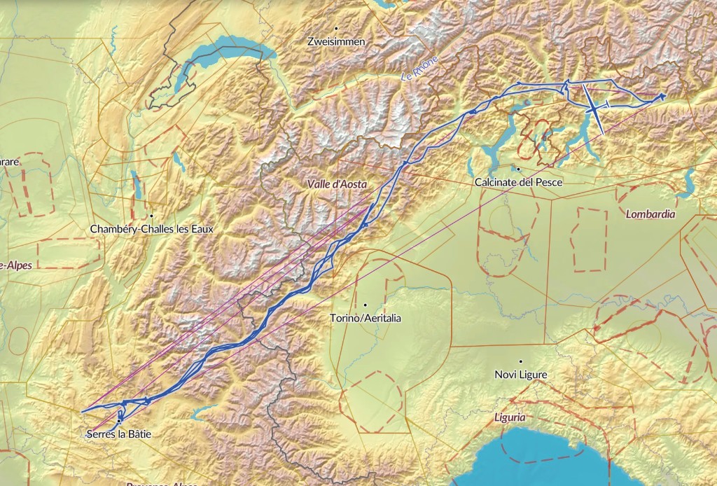
Elevation Cross-Section
Click points on the map to create an elevation profile between them.
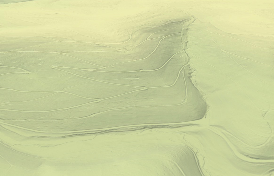
Most Detailed Global Dataset
We process terabytes of elevation data from over 20 sources to generate terrain elevation tiles. Visualized with dynamic hillshading and color reliefs, they provide an intuitive understanding of the landscape's topography.
- 5 m planar and 0.1 m elevation resolution
- Footpaths in forests and riverbeds become visible
- Perfect for outdoor/adventure use cases
Simulate the Sun's Position
Interact with the time slider to see how the sun casts shadows across the iconic Matterhorn throughout the day. Our engine calculates accurate hillshading in real-time based on solar azimuth and altitude.
Built for Ease of Use
Standardized terrain tile format with native MapLibre GL support.
Drop-in Replacement
Swap your existing supplier URL with ours in your Maps style specification to get started.
Highly Performant
Edge caching of tiles, no server-side processing involved.
Flexible Styling
Fully control the look and feel, from color gradients to hillshading.
Trusted by Innovators
"TopoTailor has completely transformed how our users experience terrain. With over 50,000 map loads a day, we needed a robust, high-performance solution. TopoTailor delivers flawlessly without any server-side bottlenecks."